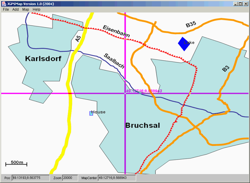
JGPSMap is part of the result of my research work at IU in the area of Wirless Ad-Hoc Networks. It is a graphical small Tool that enables to visualize GPS coordinates into a Map.

Figure 1: Snapshot of the GUI with netstumbler input
The JGPSMap is an application that retrieves and displays maps, adds elements at arbitrary positions and saves the resulting map as GIF files.
Input files for map elements are: Netstumbler summary and flexible ascii format incl. polygons using the format:
<text><TAB><color><TAB><fill/nofill><TAB><pointlist in gpscoordinates>
e.g.
"myelement red fill (49.1177,8.5911);(49.1223,8.5818);(49.136,8.5467);"
will display a filled triangle in red. Colors may be specified as "0xRRGGBB".
Have a look at BSKD.jgm for an example.

Figure 1: Snapshot of the GUI
If you are not afraid of graphical programming in Java, you can design and import your own format and easily parse and display the elements in the map. You simply need to implement a parser class extending from JGPSParser and a Map element class extending from MapElement and finally add your parser to the Config file as a parser. Have a look at JGPSMap_Parser.cfg to see how the parser is added to the config file.
Ulrich Walther for JavaGPS from http://javagps.sourceforge.net/(Coordinates libraries)
Kerry Shetline for GIFOutputStream.java from http://www.shetline.com/
(Writing of GIF files)
Please respect the copyrights of the providers of map material especially if it's offered for free.
The map pixel file is downloaded from a URL that you can specify
on your own. The default is a pixel bitmap 800x600 from
http://www.vicinity.com/gif?& CT=<lat>:<lon>:<zoom>&FAM=myblast&W=<mapwidth>&H=<mapheight>&IC=10:10:255:&DU=KM
Configuration files specify the URL, size of the map and other values. Have a
look at the sample files and have fun!!!
java de.iu.gps.JGPSMap |
just default "JGPSMap.cfg" (if available) |
java de.iu.gps.JGPSMap -nsfile <nsfile> |
and default "JGPSMap.cfg" |
java de.iu.gps.JGPSMap -nsfile <nsfile> -cfg <cfgfile> |
specific cfg file |
java de.iu.gps.JGPSMap -pos <lat> <lon> <zoom> |
map with default configuration |
java de.iu.gps.JGPSMap -pos <lat> <lon> <zoom> -cfg <cfgfile> |
map with specific config |